The Land of Pakistan
*All tables and images are taken from the book, "The Environment of Pakistan" - by Huma Naz Sethi
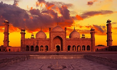
Location of Pakistan
Latitude & Longitude:
• Pakistan is located between 24⁰ 35 north and 37⁰ 05 north latitude.
• Its longitude extends from 61⁰ to 78⁰ east.
Area of Pakistan:
• Its total area is 796,096 sq kilometers.
• It is 1600 kilometers from north to south.
• 885 km from east to west.
Location of Pakistan:
Location | Neighboring Country |
| North-East | China (585 km long border) |
| West | Afghanistan (2252 km long border) known as Durand Line. |
| North-West | Wakkan (narrow strip of Afghanistan), it separates Pakistan from Tajikistan. |
| South-West | Iran |
| South | Arabian Sea |
| East | India |

Figure (i) Boundary of Pakistan's four provinces
Strategic Importance of Pakistan:
• The Khyber Pass provides a route to Afghanistan.
• The Karakoram Highway helps in trade & communication with China.
• The Gwadar and Karachi seaports provide crucial travel as well as trade facilities to north and north-west.
• Its coastline at the Arabian Sea facilitates trade with West, Middle East, Far East, and Southeast Asia.
• Pakistan has a central location that provides air routes from west to east and the Jinnah International Airport facilitates it.
• It offers easy access to Central Asia (CAS) and its 6 republics through Afghanistan.
• Feasibility of Natural Gas Pipeline Projects from CAS, India, Iran and South East Asia.

Figure (ii) Location of Pakistan
Pakistan-Iran Gas Pipeline:
• If this project is completed, then Pakistan will get 21.5 cubic meters of natural gas from Iran.
• This can be used as a fuel (CNG) for vehicles.
• It can also be used to generate electricity from thermal power stations.
Location of Provinces & Cities
Provinces of Pakistan:
• It has Sindh, Punjab, Balochistan and NWFP provinces.
• It also includes FATA, Gilgit-Baltistan, and Kashmir.
• In 2009, the Federal Cabinet approved an ordinance that gave political autonomy to northern areas.
• A new name was also given to the Northern areas as Gilgit, Baltistan.
• In 2010, NWFP renamed as Khyber Pakhtunkhwa.
FATA:
• It stands for Federal Administrated Tribal Areas.
• It is located between Balochistan and Khyber Pakhtunkhwa.
The Natural Topography
Including Drainage
Topography:
• It is the study of surface features of the land.
• Pakistan can be categorized into six topographical areas:
1. Northern & North-Western Mountains:
- Karakorams
- Himalayas
- Hindu Kush
2. Western Mountains:
- Waziristan Hills
- Sulaiman Range
- Kirthar Range
- Safed Koh Ranges
3. Balochistan Plateau
4. Potwar Plateau and Salt Ranges
5. Indus Plain
6. Desert Areas
- Kharan Desert
- Thal Desert
- Thar Desert
Northern & North-Western Mountains:
Relief:
• It includes Karakoram, Himalaya, and the Hindu Kush.
• These ranges run from west to east.
• Its height changes from 6000 m to 8475 m; south to the north respectively.
• It has deep narrow valleys namely Kaghan, Baltistan and Chitral.
• It also has snow caped, sharp and steep-sided peaks like Nanga Parbat, Tirich Mir, and K-2.
• It has Siachen, Baltoro, and Batura that are huge glaciers (snowfields).
• It has high passes including Khunjerab, Shandur, and Lawarai.
Drainage:
• Eastern tributaries include Jhelum, Chenab, River Indus, Ravi, Beas, and Sutlej.
• Western tributaries include Kabul and Swat.
Economy and People:
• In summers when the snow peaks melt, the water drain into River Indus and its tributaries.
• This drainage helps in the irrigation of Indus plain.
• These mountains are a source of valuable minerals, fruits, and timber.
• There are historic passes that connect Pakistan to Afghanistan and China.
• There is also a natural border between CAS republics and China.
• The mountains protect against the cold winds from CAS making the climate bearable.
• The beautiful scenery attracts tourists and promoting the resort business in Gilgit, Hunza, Murree, Naran, etc.
• These mountains also provide the raw material for chemicals, furniture, paper, etc.
Western Mountains:
Relief:
• Kirthar, Safed Koh, Waziristan, and Sulaiman are the parallel ranges that run from south to north.
• The height expands from 2000 m to 4712 m; south to the north respectively.
• There are several valleys and low-lying basins including Bannu valley, Kohat valley, and the valley of Peshawar.
• The peaks there are not very big in height.
• Safed Koh is the only peak that is covered in snow.
• There are many historic passes including Bolan, Gomal, Khyber, Tochi, and Khurram.
• There are not many glaciers.
Drainage:
• The drainages include Khurram, Hab, Lyari, Tochi, Zhob, and Gomal.
Economy and People:
• The water drains in the western rivers and helps in the cultivation of sugarcane, rice, and wheat.
• The passes connect Pakistan to Afghanistan.
• The passes also connect Karachi to Sibbi.
• These mountains create a defensive wall between Pakistan and Afghanistan.
• These mountains are rich in boulders, clay, limestone ridges and sandstones.
• These mountains prevent Pakistan from western depressions.
• There are important military centers namely Kohat and Bannu.
Potwar Plateau:
Relief:
• It is an open plateau with undulating land and an extensive flat area.
• Its height varies from 300 m to 600 m.
• It has residual hills namely Khairi Murat and Kala Chitta ranging up to 1000 m.
• It has a badland topography i. e. troughs, ravines and landscapes of ridges.
• It has parallel salt ranges from 750 m to 900 m.
Drainage:
• The drainage includes River Soan, Uchali, Khabeki, and KallarKahar.
Economy and People:
• It is rich in soapstones, marble, non-metallic minerals, limestone, gypsum, dolomite, and clay.
• It has oil and gas fields namely, Attock Oil Refinery.
• On Potwar Plateau, through rainwater gram, wheat, barley, and maize are cultivated.
Balochistan Plateau:
Relief:
• It has ridges and eroded landscape.
• It has barren mountain ranges including Toba Kakar, Hala, RasKoh and Makran Coast from 600 m to 3010 m.
• There several irregular depressions including Loralai and Zhob basins.
• On the western side, there are inland drainage basins.
• There is a Lasbela plain that is marked by sand dunes and gravel.
• It has Makran Coast which a narrow coastal plain.
Drainage:
• The drainages include Hingol, Dasht, Hab, and Paroli.
• There are also temporary salt lakes namely Hamun-i-Lora and Hamun-i- Mashkal.
Economy and People:
• In Kharan and Punjgore, there are gold and antimony deposits.
• There are also gas, crude oil, and coal deposits.
• The economy is through livestock and its products and fishing at Ormara, Gwadar, and Pasni.
• There is also a vegetable seed industry.
Balochistan’s Economic Potential:
• There are gold and antimony reserves.
• By using the untapped resources of Balochistan, Pakistan’s economy can see an uplift.
• Using the crude oil, coal and natural gas present in Balochistan electricity can be generated.
• Many fruits grow in Balochistan including melons, peaches, grapes, apples, dates, pomegranates, peaches and plums.
• The economy can be boosted by exporting these fruits to Gulf countries.
• Since Balochistan’s climate is favorable more vegetable seeds should be grown there.
• By increasing the livestock and its products using scientific means because wool and goat skins have high demand in the global market.
• Moreover, the export of fish can also be increased by using modern technology at Gwadar, Ormara, and Pasni for fishing.
• The Gawadar Sea Port development can also help in the development of the economy.
Shortcoming:
• The weather in Balochistan is extreme and dry making the working condition unfavorable.
• Balochistan has the lowest population density.
• There are not enough skilled individuals and the workforce.
• The province has a shortage of water making it difficult to provide proper irrigation.
• The infrastructure is bad and there are fewer link roads; limiting the travel and trade.
• The people there are not very educated.
• The landscape is eroded with rugged terrain and ridges making it impossible to complete projects on time.
Doabs
• A doab can be found at the confluence of the two rivers i.e. a land.
- Between the river Jhelum and river Sindh, there is Sindh Sagar Doab.
- Between river Chenab and Jhelum, there is Chaj Doab.
- Between river Ravi and Chenab, there is Rachna Doab.
- Between river Sutlej and Ravi, there is Bari Doab.
Importance of Doabs:
• The terrain is flat there.
• The canal water promotes and supports agriculture.
• Urban settlement can be done without hassle.
• There are links to air, rail and road developed.
• Factories and industrial estates are established.
• Moreover, businesses, markets, and storage of raw materials of agriculture are provided.
Topographical Features
of The Indus Plain
Active Flood Plains:
• ‘Bet" or ‘Khaddar" is a narrow strip of land on both sides of the river.
• It is flooded almost every year.
• When the season of rain concludes, alluvium can be found in its dry and braided channels.
The Old Flood Plains:
• It is the area between the terraces of alluvial and active flood plains.
• When there is heavy rainfall only then it is flooded.
• Ox-bows abandoned channels and meander scars can be found on these plains.
Alluvial Terraces:
• These are areas of high grounds.
• They formed by old alluvium erosion.
• They are also known as ‘Scalloped Interfluves’.
• They can be found in Bari, Rachna and Chaj Doab in the Upper Indus Plain.
• The alluvial terraces are ideal for agriculture.
Piedmont Plains:
• They are formed in the rainy season when streams and rivers deposit alluvium at the foot of the mountain.
• They support agriculture too.
• They are also known as Derajat.
• These rivers deposits alluvium, sand, and gravel.
• These can be found at Himalayan Mountain, Kirthar and Sulaiman.
Tidal Delta:
• It is located in the south of Thatta.
• It is triangular (fan) shaped.
• The distributaries branch out from it like ribs.
• It has mangrove swamps and tidal flats.
• The land is frequently exposed to seawater.
• The land is mostly covered in swamps limiting agriculture.
• Poor infrastructure results in less industrial and commercial activities.
• The undeveloped road makes it difficult to transport in heavy vehicles.
• The frequent tropical cyclones damages shanty homes, agriculture, and fishing.
• These features of the Indus Delta have resulted in a low-density population.
Rolling Sand Plains:
• Rolling sand plains are usually found in desert areas because sand dunes are a feature of deserts.
• In deserts, the wind blows and changes landscape frequently which results in sand dunes.
Cuestas:
• These can be found in the Lower Indus Plains.
• In Sindh, these are limestone made ridges.
• The ridges support the construction of barrages and irrigation.
Deserts of Pakistan
• There are three desert areas in Pakistan:
- Between river Jhelum and River Indus, there is the Thal Desert which is also known as Sindh Sagar Doab.
- In the south-eastern part of Pakistan, there is the Thar Desert. This desert can further categorize into Tharparkar, Nara, and the Cholistan.
- The Kharan Desert can be located in the western Balochistan.
Features of the Deserts:
• There is water scarcity because of low rainfall.
• There are fast blowing winds that frequently change the desert.
• Rolling stone dunes, lack of vegetation and rocks are other main features.
Climate
Highland Climate Zone:
• It includes Western, North-Western and Northern highland.
Temperature:
• In the Northern Mountains, the summers are mild and short while in the Western Mountains, it is warm and dry.
• In highland, the winters are cold, snowy and long.
Rainfall:
• The rainfall is associated with altitude in mountains.
• The Northern Mountains (2000 m – 8000 m) experience heavy rainfalls while there is less rainfall in the Western Mountains (1000 m – 4000m).
Lowland Climate Zone:
• It includes Upper and Lower Indus Plain.
Temperature:
• It has hot summers with high temperatures.
• The winters are cold there.
Rainfall:
• In the lowland, thunderstorms are very common.
• It experiences the monsoon rainfall.
• From north to south the amount of rainfall differs.
• In comparison to the Indus Plain, the foothills of the Northern Mountains and Potwar plateau are wet.
Coastline Climate Zone:
• It includes Karachi, Makran and Indus Delta’s southern coastal strip.
Temperature:
• The sea breezes keep the temperature-controlled and low in these areas.
• Humidity is very high (above 50%).
• The average temperature in coastline areas is 32⁰C.
Rainfall:
• Rainfall is low.
• The Makran Coast experiences rain in winter whereas Karachi and Rann of Kutch experience it during monsoon.
Arid Climate Zone:
• It includes South-Eastern deserts and South-Western Balochistan.
Temperature:
• These areas experience extremely hot temperatures with dry weather.
• The dust storms are frequent there.
• There are dusty winds from the mid of May to mid of September.
Rainfall:
• There is low rain in winter in south-western Balochistan.
• The south-eastern desert experiences less rain in summer.
Factors Affecting Pakistan’s Climate:
• Southern Pakistan is closer to the equator i.e. why the temperature there is higher as compared to Northern Pakistan. This effect is known as the latitude effect.
• The areas near the coastal areas have maritime influence that moderates the temperature. This effect is called the continental effect.
• With an average increase of 1000 meters in altitude, the temperature experiences a drop of 6.5⁰C. That is why the air is denser at sea level and less dense at areas with high altitudes.
• The cloud cover effect is an interesting factor that affects temperature. During day time if the sky is covered in the cloud it will make the temperature drop by reflecting the solar radiation in outer space but in night time it will make the night hot by not letting the heat left to the outer space.
• The latitudinal position of the earth to the sun (angle of the sun) also affects temperature. The northern hemisphere during summer is tilted towards the sun and absorbs more heat.
Sources of Rainfall in Pakistan:
• Following are the sources of rainfall in Pakistan:
Monsoon Winds:
• Northern areas and the Indus Plain experience the Monsoon Rains brought by monsoon winds.
• The monsoon winds start to blow in June and bring with them heavy rainfall in July and August to Punjab.
• The monsoon rains are experienced in Pakistan when high summer temperature heats the tropical continents and a zone with low pressure is formed.
The Western Depressions:
• The Mediterranean Sea is responsible for creating western depressions that bring rainfalls during the winter season to western areas of Pakistan.
• These rains are experienced in Quetta from December to March.
• These rains originate from the Mediterranean Sea.
Convectional Currents:
• In May and June, Khyber Pakhtunkhwa and northern Punjab receive rainfall because of conventional currents.
• Since there is a temperature inversion layer in southern Pakistan during summer, therefore, it does not receive the conventional rains.
• These rains are experiences in the north-western and northern areas in Summers from April to the start of June.
• These rains are a result of high temperatures in summers.
Relief Rainfalls:
• The Western and Northern Mountains receive the Relief Rainfalls because of high altitude.
• Kabul and Murree experience rainfall in every season.
Tropical Cyclones:
• The coastal areas occasionally experience destructive and heavy rains that are brought by the tropical cyclones from the Arabian Sea.
Pressure and Winds:
Summer:
• In the summer, the temperature is high in central Pakistan.
• Since the high temperature has low density, it rises and creates a low-pressure zone.
• In the sea area, the temperature is relatively low in summers as heat discharges at a slow pace.
• In sea areas, the pressure is high during summer.
• The monsoon winds travel from sea to land as a result heavy rainfall is experienced in the lower and upper Indus Plain.
Winter:
• In winter, a high-pressure area is created as the pressure increases gradually on the land of north-west Pakistan.
• Monsoon starts to retreat in fall and land winds start blowing that is dry and light.
• These winds are known as north-east monsoon or winter monsoon.
• These winds are responsible for heavy rainfall in the lower and upper Indus Plain.
Climate and Its Effects on Economy and Life of People:
Highland Zone:
• The temperature falls below the freezing point in the northern areas.
• The trees' growth is slow, grass in snow and there are frozen rivers.
• Framing is not an option in highland during the winter season.
• People who live there raise money by making pottery, embroidery, carpets, etc.
• The population in Khyber Pakhtunkhwa is meager because of barren hills.
• They also practice transhumance i.e. the transfer of livestock from lowlands to highland during winter to summer respectively.
• Most of the tribes there are nomadic.
• Peshawar is the greenest area with high irrigated fields, orchards, and woodlands.
• In the north, outdoor economic activities are hard to carry out.
• In the south, the temperature starts to increase in winter and summer.
• The western highland includes the Balochistan’s mountains that have harsh and dry weather.
• There is water scarcity which led to less population and crop cultivation.
• Grapes, mangoes, apricots, and apples grow there.
Arid Zone:
• It occurs in Kharan Desert and the southeastern deserts.
• There is low rainfall, very high temperatures in summers and mild winters.
• These areas are not suitable for human settlement and cultivation.
• Most people who live there, practice nomadism.
• Karez is practiced there which is a unique irrigation system that allows groundwater to be tapped by a tunnel.
• The highland areas of Balochistan grow fruits like melons, peaches, apples, and grapes.
• Barley, millet, and wheat also grow in these areas.
• Sindh and Punjab's southern part encounter very low rainfall resulting in high temperatures and less crop cultivation.
• Nevertheless, farming has been reclaimed in some areas of southern and eastern Punjab by constructing perennial canals.
• These areas now grow oilseeds, cotton, rice, and wheat.
• Thar desert is still barren, water is scarce, and people travel one place to another in search of water.
• The people of Thar also wear turbans and thick clothes to protect themselves from the scorching heat.
Lowland Zone (Semi-Arid to Arid):
• The plain of Punjab is very fertile.
• The summers are very hot, and winters are mild.
• It is the most productive agricultural plain in Pakistan.
• Rain is irregular but an effective canal system is in place to offer proper irrigation.
• Sugarcane, wheat, millet, and cotton grow there.
• Punjab also has the most population of Pakistan because the weather there is tolerable.
River Floods:
• The rivers attract human settlement as it is a necessity.
• But sometimes access water in rivers causes floods.
• The banks of Indus and its tributaries overflow almost every year,
• In every 6 to 7 years, severe floods are experienced.
• 1955, 1973, 1978, the 80s and 90s have experienced serious floods that resulted in devastation.
Reasons of the Flood:
• Many natural and human reasons result in floods.
• The human reasons include cutting of trees, failure to heighten embankments alongside rivers, and dam’s less capacity to store water.
• Natural reasons include heavy monsoon rains and snow melting in summer.
Precautions to Reduce Flood Risks:
• Floods can be prevented by the following:
• Planting more trees on foothills.
• Expanding the river channels.
• Constructing embankments on channels on both sides.
• Constructing water reservoirs.
• Preventing human settlement near areas where flood is likely.
• Constant updates and announcements of flood warning over television, radio, and newspaper.
• Evacuation of these areas with rehabilitation facilities.
Benefits of Floods:
• Floods bring with them nutrients that contribute to the expansion of wetlands.
• They increase land fertility by spreading a layer of alluvium.
• They also recharge the groundwater supply.
• The Arabian Sea has high nutrients because of the high production of fish and these benefits are also attributed to the Indus river system.
Storms:
Thunderstorms:
• The thunderstorms are experienced mostly in the north-western and northern areas.
• From April to June (summer) and September to October (after monsoon) strong winds start to blow that is 60 km/hr to 80 hm/hr.
• As a result of these winds, hail and stormy rains start that destroy the crops.
Dust Storms:
• Dust storms are experienced due to low pressure in summer in Balochistan’s north-western and southern plains.
• The upper Indus plain also encounters these storms occasionally.
• These storms also destroy crops.
• Communication and electricity are disturbed during these storms.
• These storms are less frequent than floods.
Tropical Cyclones:
• These cyclones come from the Arabian Sea.
• They affect the coastal areas of Balochistan and Sindh.
• These storms cause mass level destruction.
• The destruction caused by these storms is also increasing when relief teams are delayed.
• To counter these damages, flood monitoring systems, warning systems, and trained relief teams must be formed.
Drought:
• Drought is a big threat to the people who live on land.
• Water scarcity is experienced due to less rainfall.
• This also destroys crops.
• The poor countries experience mass death, illness, and famine because of it.
Types of Drought:
• Permanent Drought is when cultivation becomes impossible without irrigation. E.g. west Balochistan’s Chagai, Thal and Cholistan.
• Seasonal Drought is when there are well-defined dry and rainy seasons. E.g. southern Punjab, and Potwar Plateau.
• Invisible Drought is when there is water scarcity that can reduce crop production, but it is not severe enough to destroy these crops.
• Unpredictable Drought is when there is very low rainfall. It is experienced in humid climate areas only.
Effects of Drought on Environment & Human Life:
• It can turn the land into a desert i.e. desertification.
• It can lead to dust storms, soil erosion, desert areas expansion, high temperature, extinction of species and loss of crops.
• It can dry up rivers, streams, and lakes.
• It can harm fisheries, increases the growth of algae and can make drinking water unsafe.
• It can cause water scarcity.
• It can cause a famine that can lead to starvation.
• It can make people migrate from drought-affected areas.
• It can cause malnutrition and health problems.
• It can make livestock die that can also result in a shortage of raw materials, loss of export/import and whole economy devastation.
Drought Management:
